2. The City’s Expansion
Vienna’s inner core area – past and present
The urban development of Vienna from the Middle Ages to the Present
 Click image to enlarge
Presentation
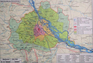
The map shows the urban development of Vienna and when exactly the former suburbs were integrated into Vienna’s metropolitan area. The individual stages of the city’s expansion are shown in the map’s legend.
Questions
Description and Analysis
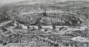
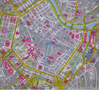
The Ring Road was constructed in place of the glacis. On both sides of the road, many magnificent neo-classical buildings were erected.
Three phases of administrative expansion allowed for the city’s population growth. In 1850, the first expansion saw 34 suburbs and villages inside the Linienwall incorporated into the city. The second phase of expansion occurred in 1890 when southern and western suburbs became part of the city. With future hopes of a population of 4 million inhabitants, 1904 saw the third phase of expansion into unpopulated areas east of the Danube and beyond.
The sudden increase in population meant that in 1908 the two million mark was clearly surpassed for the first time ever.
Answers to the Questions
- University, Town Hall, Hofburg, Burgtheater (Imperial Court Theatre), Museum of Fine Arts, Natural History Museum, Parliament, State Opera.
- To the west, south and east.
- Brigittenau, Leopoldstadt, partly Favoriten.
- From 1892 to 1918.


Presentation
In 1857, the Ring Road was constructed on the previously vacant land outside the city walls.